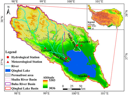
The article examines the impacts of climate change on Qinghai Lake’s hydrology from 1961 to 2019, highlighting changes in water levels and surface area. Located in the Tibetan Plateau, Qinghai Lake is sensitive to climatic variations and has experienced two distinct phases: a decline in water levels and surface area from 1961 to 2004, and a significant increase from 2004 to 2019. During the first phase, the lake’s water level decreased by 0.80 m per decade, while from 2004 onwards, it rose at a rate of 1.80 m per decade.
The study attributes these changes to climatic factors, particularly precipitation and river runoff. Increased precipitation (with a notable rise since 2004) and river discharge greatly contributed to the lake’s rising water levels, while evaporation trends have also shifted, showing a reduction during the latter phase. Seasonal variations were evident, with water levels rising in summer and dropping in winter. The research utilized in-situ measurements and satellite remote sensing data, demonstrating a strong correlation between lake levels and precipitation, underscoring the importance of these climatic factors in understanding hydrological processes in cold regions affected by climate change.


